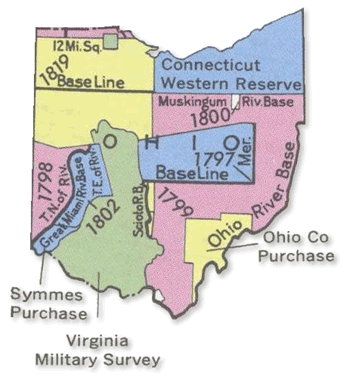
The Public Land Survey System (rectangular survey system) surveys and identifies land parcels; either public or for titles and deeds of rural, wild, or undeveloped land. The units of area within this map is the township and section by year of the establishment of the border.
No comments:
Post a Comment